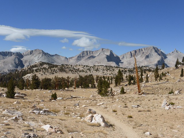
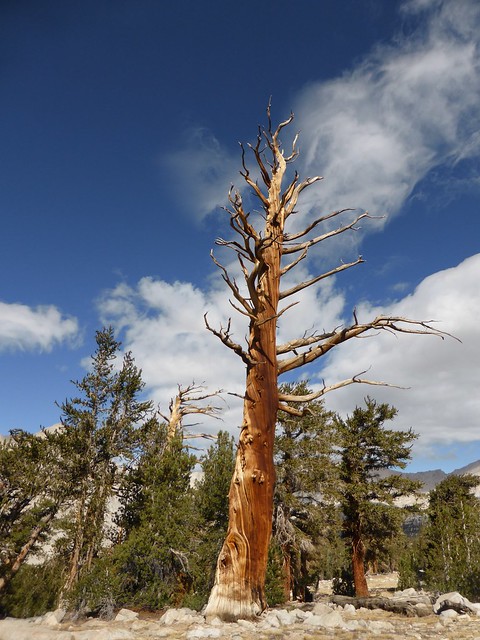
Headwaters of Tyndall Creek and Beyond, Late September.
I had been wanting to get over Shepherds Pass to fish the upper Kern region and trek under the divide for some years now, it's part of my personal effort to get all 4 of those east side brutes under my belt and fish the less obvious waters before I retire.
The last visit was WAY back in the mid 1970s. On that trip, I went up and over Foresters Pass, back up through Center basin, over Junction Pass then out.
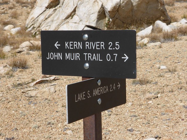
The initial game plan was to participate in the Mav's Meetup, but that did not happen, so I sketched this itinerary: Over the pass, visit the numerous lakes at the headwaters of Tyndall, over to Lake SA, then a loose interpretation of the classic loop around the headwaters of the Kern.
Pre-trip. As with all my trips, it all starts some weeks earlier by dehydrating various foods, testing the menu, purchasing items I think is needed, but never are. Case in point:
A nifty shower head that fits on any water or soda bottle and the 2 liter size Platy water bag. Did not use it once.
A large Tyvek groundsheet, that I found too big, bright white and noisy, so left it in the gear closet.
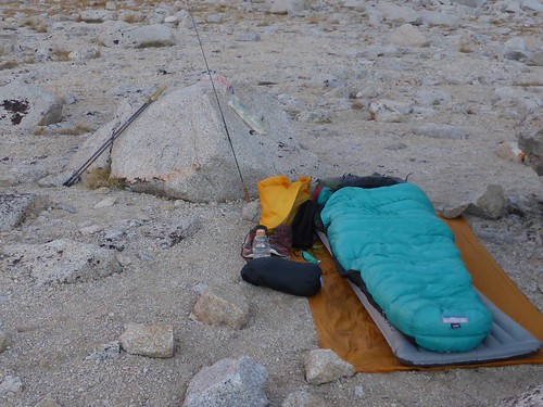
A Gossamer Gear cubin tarp with poles. There was no rain in the forecast, so this got into the pack. I was out the door at just under 27 pounds for 6 days.
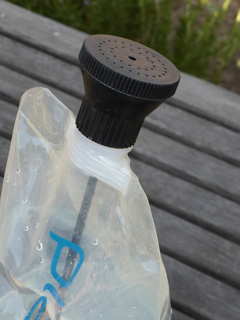
Took it, but never bothered to use it. Better suited for a rinse off after a session in the surf.
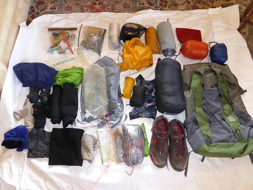
I filed the R-Conn form and I was out the door at just under 27 pounds.
Day one. Lot's of folks coming out, not so many going in. Those coming out included many mountaineers doing Williamson in a day. I was at Anvil by 4 PM and they were still coming off the pass, heading back to the trailhead. Strange spidery beings in spandex, hydration-packs, and helmets on their way back to the City, home by midnight and ready for work or school Monday morning.
The first day is never easy is it? It's 0 to 10,500 in 6 plus hours and I was feeling it, but enthusiasm and anticipation always prevail.
I was able to get across "The Washout" trusting some very marginal handholds without too much deviation from where the trail traditionally crosses that area but my heart was really racing after those moves and more than ready to find a site at Anvil. The situation at this washout is very ugly. When you pickup the Permit, the Ranger makes no mention of it and I didn't ask. It's in steep terrain, and both sides of the washout are vertical, consisting of large rocks resting loosely in decomposed granite. Both sides are about 10 to 15 feet deep. Many thanks to those Topix members who posted maps, descriptions and pictures but there is no established easy safe way.
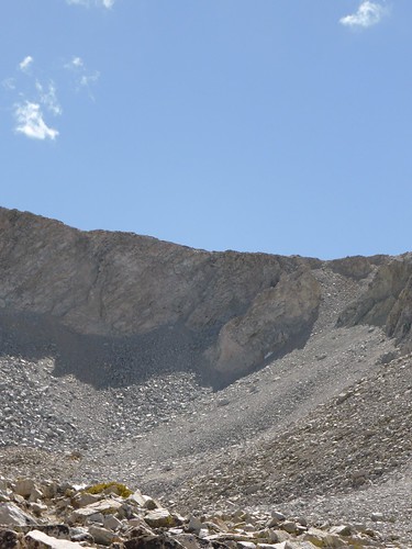
The trail crests the ridge in the talus field tongue to the right.
The next day, over the pass. After gaining Anvil, the traveler feels like he must be "almost there" but that's not the case. There is much more to traverse, all of it above timberline. The trail is well constructed through difficult bolder and talus fields until the crest is reached in a very steep section of a talus field "tongue".
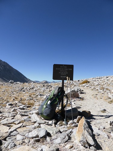
Welcome to the Park.
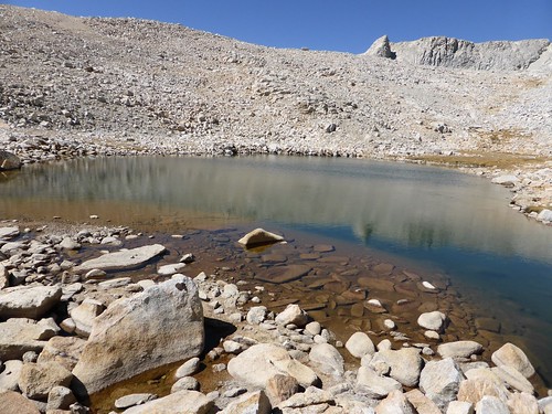
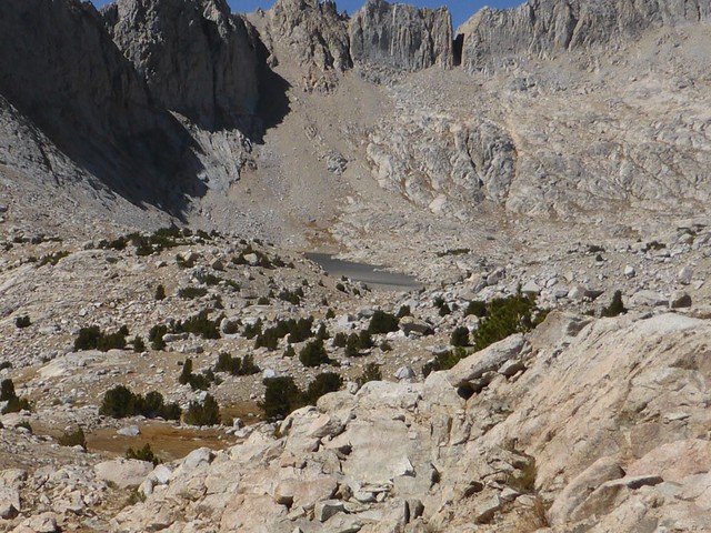
My first objective was to visit a group of insignificant unnamed lakes located in a basin between Diamond Mesa and the crest northwest of the pass. Often this type of area can be overlooked so close to the pass by those who seek more isolated and beautiful settings to the west. The first lake was no longer a viable lake, or even a tarn, the drought had done it's damage and tainted my mind that the following lakes in this basin would be in the same state of starvation. To my surprise, the next lake was small but still healthy, and even better, fish were rising. I wasted no time in setting up my rod to try my luck for what I guessed to be Goldens. There was no wind on the lake, the fish easily visible, and very aware of my presence, but before long I coaxed a strike and landed a 12" Rainbow! The session lasted for more than 2 hours before they all laid down and disappeared, making the lake appear completely fishless.
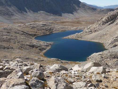
Lake #2. A 3rd much larger lake lay beyond the small ridge in the foreground. There are no signs pointing the way now.
After getting sidetracked for a couple of hours, which happens to me with greater frequency these days, I finally reached the largest lake in the basin. This lake is split in two, with a shallow section to the east, and a much larger deeper section to the west. The eastern side was lit with fish rising, the west had only occasional rings, but I was so exhausted by the end of the day, making camp and dinner left no energy to setup my rod to cast on the deep end. I would have to save it for the next morning.
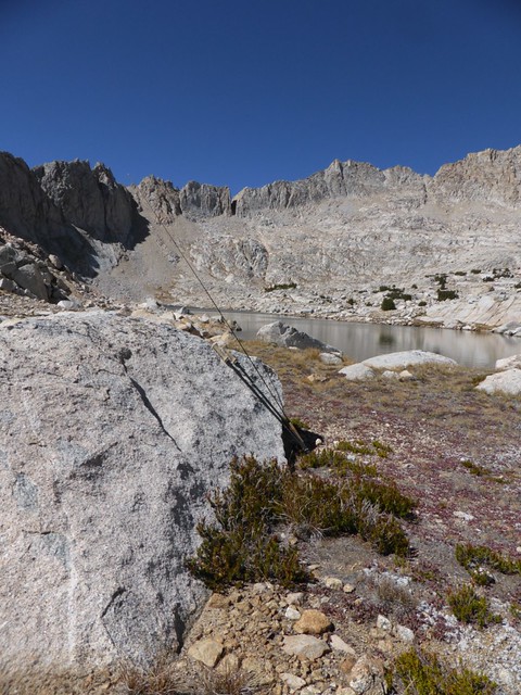
No rain expected at Lake #3 and no evidence that this area is a popular overused camping destination.
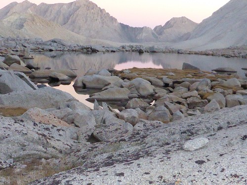
The shallower eastern section, looking south into the Williamson Bowl some miles distant, as viewed from the campsite.

The much deeper west end.
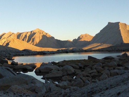
One final look into the Bowl.
Day 3. Lesson of the trip: As a fly fisherman, when you see fish, don't wait, fish it! The next morning the lake was glassy, not a ripple, including... no fish rings. I cast and combed the lake, nothing, not even the shallow east end that had so many rises when I had arrived the evening before. It now looked completely fishless, for some reason, they were really hunkered in. Bad weather coming? Hmmmm. Considering the location to such a popular trailhead, there was no obvious evidence of any recent visits and I believe this lake holds larger than average Rainbows, maybe even Goldens, but that will have to be for someone else to discover, I needed to move on.
The large east end of lake #3 as viewed from the ridge separating drainages.
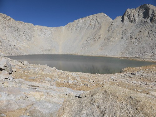
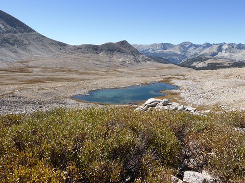
Instead of retracing my steps back down this drainage, I crossed a small ridge that drops into another set of lakes. From the ridge the highest lake looked deep, and promising for fish, but when I got there, nothing. the second lake was much shallower with many small fry scurrying for cover as I trekked the shoreline, but again, nothing bigger cruising or gulping bugs on the surface.
The larger deep lake.
The Shallower of the two lakes with many small fry. Is that Rockwell pass in the foreground?
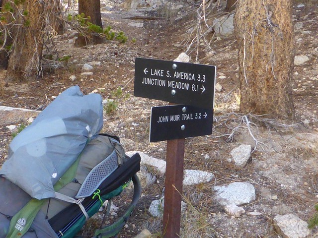
Time to pack the rod and head on down the trail to my next destination, Lake SA to test the waters and hopefully hook into the fabled Goldens that inhabit this area.
I stayed on the north side of Tyndall creek and picked up an old trail with many healing ruts that eventually hit the JMT in an area closed for restoration. I decided to stay on the trail to LSA, there was no reason not to since I had not seen anyone since cresting. I passed up many small lakes before having lunch at the last lake before crossing "the hill" and dropping down to LSA. As I ate, I watched healthy sized fish taking insects in the wind chop, this really got me energized to get over that hill and get my rod reset for LSA. An hour later I was there, and nothing, LSA was, by all appearances, fishless. My only thrill for the entire session was retrieving my fly in frustration, when suddenly something very big and golden appeared out of the rocks, then disappeared just as fast. So,They are there, but not for me and what I had to offer. Again, I kicked myself for not fishing the gulping fish in the lake on the other side of the hill, feasting on flies in the wind chop as I ate lunch.
LSA is a very popular destination, and it shows, but I had it to myself this night and enjoyed the view of towering crests in all directions.
Day 4, Getting to the Kern. The terrain and their respective drainages, is somewhat convoluted, but not difficult to traverse. Today I wanted to check out the many lakes to the west, but not directly downstream to LSA, so I walked over to the head of the lake (Columbia?), crested a small ridge, then dropped into separate drainage that held many small lakes downstream. In these lakes I caught many small Goldens and Rainbows. In one of these lakes, I was catching both, but no hybrids, it was one or the other.
Goldens and Rainbows, either or.
Another nameless lake, with a strange rock. Stupid thoughts wander into my mind when I see this stuff. An abandoned Flintstone monitor?
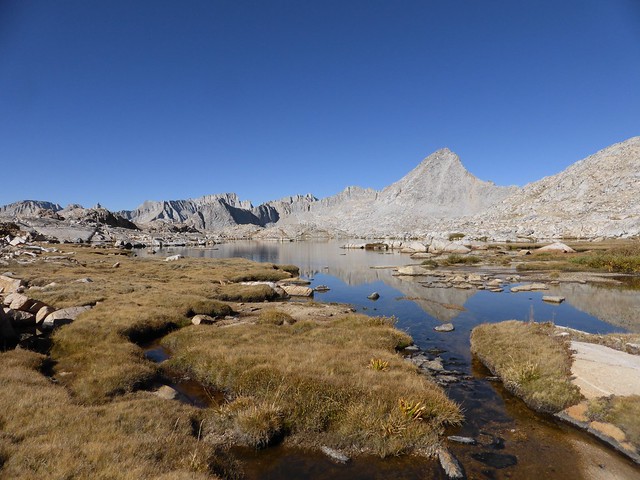
After fishing from lake to lake in this region, it was time to refocus my efforts on another lake that lie tucked into one of the many basins that help form the Kings-Kern divide.
Time to check out another basin under the Kings Kern divide.
This one involved some uphill route finding, but again, nothing too tricky and I was there by mid afternoon. As soon as I got to the lake outlet, I knew this nameless lake held fish. Big fish, rising to unseen bugs on the glassy windless surface. Beautiful brutes, and the water so clear, I could see the dark and colorful display of their skin. They were wary and wily, flapping their tail fin at my fly in snobbish refusal for what I had to offer. My casts laid them down quick, then they vanished. I took a break to let them settle down then casted another section of the lake and the action was on again, getting some incredible strikes and stokes this time, but landed none. Word had finally spread among them of my attempts, so now the lake was completely shutdown. And so it is with these lakes, I knew it could be this way for hours, so I broke my rod down and left.
They went deep on me, time to go.
By now I was again starting to feel tired from dividing my time between route finding and fishing, but I could still see even more lakes as left this one behind, so I aimed for another tucked into a timbered area. Big mistake. Somehow I missed it, then found myself in an area with many small ponds choked with grass lying in timber and steep canyons and became lost from traversing the area. All these ponds were stuffed with small ferocious Goldens, clearing the water to snag flies on the wing. I finally stumbled onto the large lake I was aiming for, but now nothing looked familiar like the morning, I was unsure of how to get back to the trail. Go back up the drainage, or down? I knew I was on the Kern now, so I headed down stream and eventually reunited with the trail at a small lake and made camp for the evening, completely exhausted, but relieved to be on track again.
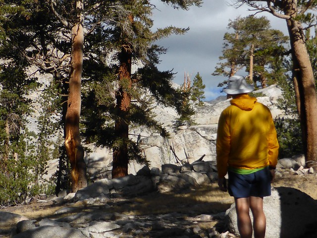
Happy to be on the trail again. Daypack filled with lunch and fishing gear riding piggyback.
Day 5, the storm. Today was the day I had to start the trek back. As I laid in my bag awake, waiting for the sunrise, I stared at the cloudless sky and peaks, then suddenly, there was a small cloud. By sunrise the southern horizon was covered with clouds streaming northward. Another monsoon, or worse, an old hurricane?
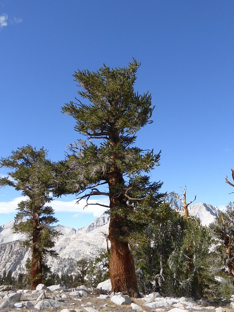
The long-range forecast for this day was a transition in weather, so there it was, happening, but to what? For the region I was in, the weather quickly evolved into a gale out of the west. I was not panicked, but made haste with repacking my gear and headed east through a region of beautiful timber. After being in the alpine zone for so many days, it was a wonderful change to see these wonderful tree forms.
A change is coming. Time to head east.
As the day progressed, so did the wind. By the time I was well on my to reaching the crest at Shepherds pass, the wind was blowing a steady 40 mph, with gusts to 50 mph. My trekking poles took on a new assignment- keep me vertical!
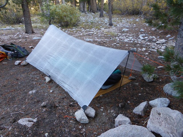
After I crested, a new fear gripped me. The eastern face at the top of this pass is very steep, almost vertical, and the wind was now aimed perfectly to blow me off the trail. By the time I rolled into Anvil, I again was completely spent, but still had to get my tarp set up since i didn't know if this storm was going to be just a lot of wind, or evolve into a rain and snow. There is truth in the concept that tarps suck in the Sierra because of the soil and real estate needed to get a good pitch, but fortunately I had the camp to myself, and could pick and choose a good site. After I go it set up, I was pleasantly surprised at how well it blocked and shedded the wind.
The final day. It was all down hill, mostly. But I still had to get by THE washout again. For some reason, I really messed this one up. I tried going downhill, following some ducks. Finally, but not easily, I was in the gully, then went downstream, and back up again before finding a very marginal way out. Once again I was on my way, heading back to the car, a Habenaro super sized burger meal at McDonald's, and home.
I did pass several hikers heading in. None of them knew about that washout, so I told them the best I could, but knew they would have to figure it out on their own just like all the rest of us. Much later I also learned that my windstorm translated to a full on snow maker further up the Range and lingered for a few days there after.
“It's not down on any map; true places never are.” ― Herman Melville