Sunday, December 29, 2013

Little Pine Spring


One of the many aspects I like about the Santa Cruz Trail its scenic 3000 foot elevation gain up to Alexander Saddle below Happy Hollow. Great training for Sierra passes. Also let me mention, the trail is in great shape, thanks to the many volunteers who have been chipping away at it since the Zaca fire. Even the bicyclists have helped, since this is a very popular downhill single track run, and their presence has kept the encroaching chaparral at bay.


At the beginning of my one week Christmas holiday vacation, I had a two day window of opportunity to get an overnighter in, and put some of my backpacking gear to use, especially the wood burning stove. I recently read that the side trail to Little Pine Spring had been cleaned up. I have never been able find it because the thick grass quickly overgrows the trail and the Zaca fire added to the chaotic appearance and weedy growth to the area. On my last attempt, I tried to cross the canyon bottom too soon, and an impermeable wall of oak sent me back to the main trail and on to Santa Cruz Station. 


After purchasing the Adventure Pass for my parking at the little kiosk before the river crossing, I was at the trail head (along with dozens of cyclists and boy scouts) and on my way, my pack weighing in at about 18 pounds. Nice and comfy for an overnighter. The trail was shaded as a result of the low winter sun angle so it started out rather chilly, enough to don a windbreaker which was soon shedded after the sun finally found the trail. 

As I reached the upper trail just below the saddle, the cyclists where on the trail after taking the road to Happy Hollow and on their downhill single track run back to the trial head at Upper Oso. After I crested the saddle, I had it all to myself. The trail on the backside was just reworked and in great shape, much better than it was on my last visit.

By mid afternoon, I found the Little Pine Spring campsite and settled in to its inviting fire ring, crickity table, and welcome seclusion.


I set up the tent (Big Agnes UL Fly Creek 2), first under the shade of a big Oak that survived the fire, then after a quick nap, moved it closer to the fire ring and table.


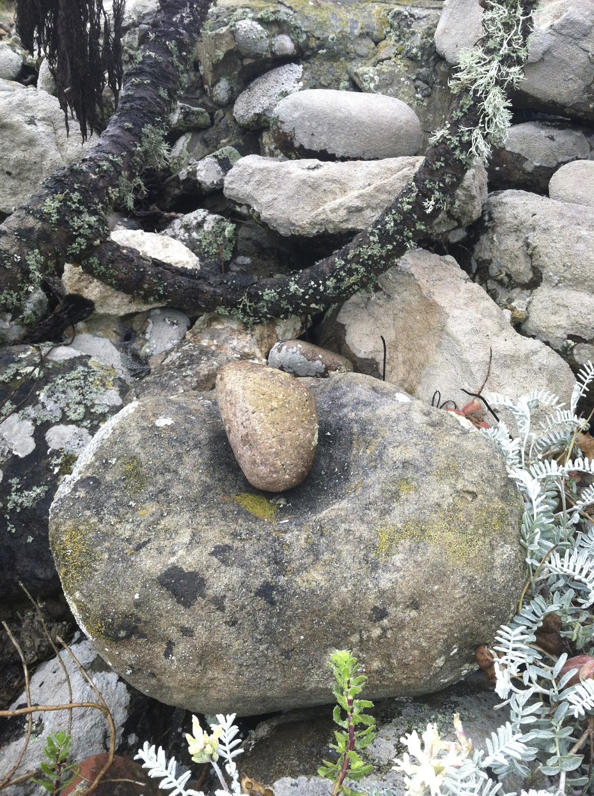
I quick exploration of the camp revealed the spring trough and remnants of an ice can style fire box that was the fire box of choice when these sites were first developed.


The weather was perfect, not a breath of wind, nor the incessant buzzing of gnats trying to fly into the facial orifaces.  Perfect for simply hanging out in camp and relaxing. Eventually I got around to breaking out the Bushbuddy wood stove. The fire restrictions had been lifted so time for some old fashion fire time!


I collected wood for the stove and the fire ring, making sure there was oak bark in the mix for the stove, since steak was on the menu for the evening supper.


A meaty filet mignon, flour tortilla, and a cup of green tea. I dubbed it my "LosPadres taco".
2nd course (not shown) was refried beans on another tortilla.

After I finished this wonderful meal I cleaned the fire soot from my pot using the nylon storage bag for the stove. As you rub the nylon over the bottom of the pot, the soot falls between the mesh and soon the bottom has a nice hardened black patina.


The evening fire helped with the cool chill of the evening, but it never got below freezing. In fact, I brought my Western Mountaineering Veralite bag and was almost too warm. I think I would have been just fine in the Valandre Mirage, my summer bag.

The next day was a carbon copy of the day before, the  wonderful  sun lit mountain air and a perfect stillness in the windless conditions. A perfect start to my Holiday and a nice way to end 2013.


Sunday, October 6, 2013


Another Taboose Tale of Nameless Lakes


It's hard to go over Taboose Pass and not have some sort of memorable experience. Of course, that can be said for backpacking in general, the traveler can expect "the unexpected" and play it according to ability and luck. This trip was no exception. Oh sure, it had all the inspirational views that we come to expect, but this year mother nature combined all her furies to make sure I would remember this trip for all the weather and clouds, instead of the endless sun-drenched days and 14 inch Rainbows that we can expect in September.

Looking east from the unnamed lakes below Venacher Needle area.

Image


I will start with the weather report for my week, beginning on Tuesday, the first day of my planned 6 day trip to include visiting the unnamed lakes below Venacher Col. The NWS chalk board report at the Visitors Center called for monsoon conditions ending Wednesday.

Thursday dawned cloudy, windless and ominous. The clouds and sky roiled all day, culminating in a late afternoon storm that went well into the evening. Each day, the clouds played the same scenario.

Camped at the unnamed lakes.

Image

My well being? I felt great the first two days, full of optimism to visit nameless lakes in the Kings river drainage and catch trout. Those were the best days of the whole trip. Thereafter I my body felt like the boiling sky, unpleasant intestinal feelings washing in and out in varying degrees of intensity, but always there to remind me that I was not feeling at the top of my game, and a long way from home.

Patiently waiting for a break in the weather and intestinal rumblings to fish.
Image

Looking back on the lower lake

Image

The upper lake below Venacher Col. These lakes are fishless.
Image

Image

My wilderness skills? I survived all the rain in a new tent setup dry enough, but made the mistake of leaving camp in an excited state to go fishing for Goldens, and not covering my gear for the rain. Before I knew it, I was in the Upper Basin, no windbreaker, sky boiling, and me with thoughts of a downpour onto my sleeping bag and clothes airing on the rocks at camp. Fortunately, I made it back just in time, gathered my stuff back into the tent to wait out the shower.

The evening sky reloading for the finale.

Image

Stripped Mountain reflecting the red sky sunset.
Image

Wandering the Upper Basin
Image

Image

Image


Best tree of the trip, every trip has it's standout. This one was in the Upper Basin on the JMT.
Image

The weather never really let up and the fishing was mostly 6" Goldens (not complaining!), but the rain really settled the dust cleared up the air, and I actually enjoyed the windless Monsoon conditions and stillness. Not pictured is how the foliage really perked up from the rains. The native grasses were at their best, with stalks of seed-heads shooting up and shimmering in the breeze. For me, this area is one huge and unending Zen Garden.

A High Sierra Topix member siting! On my last day, I met Tomba, lithely bounding up the eastern side of Taboose, on his way to the Upper Crossing and points beyond. The weather had a few surprise nuggets for him as well!

Image

Image
Bend your barbs!

Tuesday, September 17, 2013

Discovery on San Miquel Island


San Miguel Island is a Channel Islands National Park destination that is a rare bird of sorts. It's considered one of the outer islands, along with Santa Rosa, and getting there involves a long boat ride that crosses some of the roughest seas on the west coast. This trip was no exception.

Even at check-in they were telling us that we might not get there, and to please consider alternatives. Even as we unloaded campers onto Santa Rosa, the skipper was hedging his bets.  After consulting his charts and reports, the decision was to give it the 'ol college try. I was impressed with his skills to handle the large craft in 10 foot seas without too much sea sickness discomfort to the passengers. Even after all that, and we were safe in Cuyler harbor, he was now telling us that the skiff may not be able to safely land us onto the beach through the surf. The final landing turned out to be a piece of cake, since there was no ground swell that would cause dangerous shore break, only wind chop. So all us campers were safely on the island, and commenced that steep hike up to the camp ground after our Volunteer Ranger orientation.


 Unlike Santa Rosa, travel on this island is regulated. Cuyler harbor is just about the only place a hiker can go unescorted or without permission. All other destinations require Ranger accompaniment. Luckily, the Rangers are very accommodating, and offered our group ample opportunities to hike everyday of the trip. There was no obligation to go, one can find plenty to  do and see within the boundaries outlined by the Ranger. On one of the days I did just that, and made some wonderful discoveries, all within bounds. The first was at the Cabrillo Monument. During the obligitory picture shoot of the Monument, and trying to get a different view point, I noticed at the Monument base, a large Chumash grinding stone.
 Just below that stone, was a small round stone, that looked like the grinder that complimented the larger stone, so I put them together, then contemplated the odds of the monument erectors actually knew what they had used.

The center piece of any visit to this island, is the hike out to Bennett Point to view the California Sea Lion breeding colony.This was our destination on day two.
 Right next to our viewing location was a huge Chumash midden, loaded with perfect ancient abalone shells.


On another organized hike, we visited a large Elephant Seal breeding area and witnessed this interesting standoff between two bulls. Please note the disinterested females.


Later the same day, I took a solo hike to the tide pools on the southern reach of Cuyler Harbor. The day was cloudy, but the tide pool life remained colorful and abundant.

 Our final day on the island had the best weather, in fact, it was the first windless day in months on San Miguel Island!
Looking toward Santa Rosa Island.
Surf rolling onto one on the many point-bay setups on this island. No crowds except the body surfing pinnipeds.
This weather held for the rest of the trip, and the return voyage was smooth as silk. These conditions made for perfect and abundant viewing of marine wildlife to keep us on our toes until we were on the Ventura Flats. What started as a wild roller coaster boat ride, ended as a relaxed sundrenched afternoon filled with easy conversation and Micro brew beers to wash down the grit of the previous windy island days.


Tuesday, June 18, 2013

A Press Release From the Inyo County Sheriff Department

Remains recovered in Sequoia National Park - Might be hiker missing since October

Published on Jun 18, 2013 - 7:01:59 AM

By: Cpt. Terry Waterbury, Inyo County Sheriff Office, SAR Coordinator

June 17, 2013 - Search efforts have continued for 53 year old, Lawrence Conn from Pacific Palisades who went missing last October during one of winter's first snow storms. Conn failed to return from his solo hiking/camping trip into Sequoia National Park. After friends reported him overdue, Conn's vehicle was located at Taboose Pass trailhead in Inyo County. A joint search effort was conducted between Inyo County Sheriff's Office Search and Rescue and Sequoia National Park.· Due to the accumulation of snow and no signs of Conn, search efforts were suspended.

On 06-09-2013, Search teams from the National Park Service, Inyo County SAR, and Sierra Madre Mountain Rescue Team conducted joint efforts to locate Conn. A hiking shoe similar to what Conn may have been wearing was located a short distance inside the Park off the main trail near the pass. The discovery of the shoe redirected the search teams from the approximate 100 square miles of search area to the Taboose Pass area.

On 06-15-2013, in the early afternoon search teams located a windblown tent and several other items off the Taboose Pass trail in Inyo County at about 11,500 foot level. The tent matched what Conn was reported to have used. Concentrating efforts in that area, search teams discovered a cell phone which was determined to be Conn's and possible human remains.

The remains have been turned over to the Inyo County Coroner's Office for positive identification.

Larry Conn Has Been Found


Larry’s remains were found just east of Taboose on the weekend
of the 6/15-16. His tent was outside of his backpack, possibly set
up? His backpack was near by, both pieces of equipment were torn
open. His iphone was also found which contained photos of the
snowstorm. Some of his remains were also found that was sent
off for dna testing.
The iphone has not yet been release so we have not been able to
see photos, it will hopefully shed some light on what Larry
was experiencing on his last day. We have not been informed about
whether his sleeping bag was still in the backpack or not, which
would shed some light on possible scenarios that may have transpired.
So far it points towards Larry climbing up Taboose Pass during the
storm (this is where the photos would help), set up camp once over
and slightly down trail from the top of the pass to avoid the wind,
then set up his tent and suffered some fatal medical conditions.

Sunday, June 16, 2013

Valandre Mirage Sleeping bag


I always had puzzling thoughts when reading about backpackers having multiple sleeping bags in their kit. For years I was a one bag for all seasons dude. That has all changed with the addition of the Valandre Mirage to the gear closet.


With this bag weighing in at 1.7 pounds (799gram), I will reduce my shelter gear by a pound over my Western Mountaineering Versalite. I never had a cold night in that bag, but I did become frustrated on more than one night with the draft collar and hood system.
there is no draft collar on the Mirage, and a different design for the hood will hopefully take care of some of that. Hoods are inherently frustrating for anyone who is a side and prone sleeper like me, but I'm not ready for a quilt system because of the ever present possibility of drafts washing out the warm air. Instead, the challenge for me is to develop a sleeping technique to turn with the bag, instead of just inside the bag.


The general shape of the bag is somewhat unique and is designed for comfort to 20 degrees using goose down as the insulator. More on that later. Instead of a gradual consistent tapering to the foot box, Valandre keeps the bag on the wide side to a point at the hips where the arm ends, then reshapes to conform to the legs. One last shape change is at the foot box where it opens up to the shape of an anatomic foot.


 The 3/4 length zipper is protected by a draft baffle to discourage cold air seeping in.


 Valandre uses goose down from geese specifically raised, and humanly slaughtered. Because geese fly at very high altitudes, the shape of the feather is unique for retaining warmth at the core.

The product comes with 2 stuff sacks and a storage bag.


It all sounds logical to me, but the defining moment for me was getting into the bag, zipping her up, then immediately feeling the warmth gather around me. The first thought is always the truest and "toasty" was that thought. It's a keeper and the bag count is now up to three.


Tuesday, June 11, 2013

Larry Conn, Missing Hiker Update

A shoe has been found. According the note sent to me from the Sheriff's department asking me to remember the color. It was found by a searcher on a ridge line north of Taboose pass. The image of the shoe was sent to me by the High Sierra Topix moderator, Maverick.


I failed to identify the color correctly. I also commented that it did not have a lot of loud colors and it does not, only the orange. What I did recognize from my brief encounter with Larry was the broad toe box and wide lace area unlike most trail runners with narrow sleek lines and sent a note to the Sheriff's department stating my observation..

I think they are hot on his trail and have eliminated hundreds of square miles of search location possibilities.

Sunday, June 2, 2013

The Aging Soloist

There seems to be three schools of thought regarding backcountry preparedness. Those who stay solo and carry a sat devise, buddy system, and those who do both. I love to go solo, but the family hates it, they are well aware of Larry's demise and I suspect the box with a panic button isn't going to sway them much either. Now that I am about to punch into my mid 60s, I have all the time in the world to go solo, as opposed to my younger days when family and career kept me close to home. Doesn't seem fair, but life seldom is. So time to "act my age" and modify some habits.

My current mindset is to gear up with high quality basics that could see me through a unforeseen situation, develop a realistic detailed itinerary for the wilderness permit, and maintain a level of physical fitness that is up to challenges of a given route. 
I will no longer show up for my permit, scribble down some obvious name on the map, then proceed to go wherever some mountain climber reported seeing lunkers in a nameless lake. No more of those shenanigans.

I am now also seriously considering signing up on a local university or commercial group trip that has an itinerary that can offer an opportunity for advanced backcounty travel. The perfect commercial or club situation would be everyone leaves and returns to the selected trailhead on the same day, but can go and do wherever their interests lead them within the given time and area framework. The group would have a designated or paid leader with signed rules of conduct and a sat devise, acting more as a babysitter and less as a guide. Some one who says "here we are, now go play."

If they are out there, let me know, I will be the first to sign up. I would much prefer to give my money to and individual offering services rather than a devise and subscription service.

Saturday, June 1, 2013

Catching Up

It's been awhile since my last post, so I want to do a quick update, then go into the details a bit later.

First up, we are looking for Larry late July with the crew at Sierra Topix.


Next big trip is San Miguel Island, located in the Channel Islands National Park and what I consider the windest place on earth on your average summer solstice day. Yes, I will be there the day after that event to prove my point.


What am I doing to get ready for all this? Buying gear, of course! I'm taking a different tack with the kit this summer with different manufacturers including Big Agnes and Valandre. More to come on this and also to let you know,  I have not forgotten about finishing up the teapot series.

Training is also in the cards. I joined team Blister Busters to count steps on my iphone app Pacer. Instead of biking to work, I walk the 3.6 mile one way trip, or about 6000 steps worth on the clicker in 1 hour.

Sunday, April 14, 2013

Where Were You Fishing in 2002?

This report probably belongs in "The Way We Were" Section, but nothing has changed on Bear Creek...endless pools, all the way to the crest, so disregard the characters and gear, its all about the creek and the fish.
So why post this now? Call it digital rediscovery. Resurfaced from the dark corners of the closet, CDs discovered from the days when we weren't sure if it had images of a Sierra trip, last years tax reports, or a bootleg Greattful Dead jam from Dicks Picks. This happened to be a Sierra trip from 2002. (Iwas looking for the taxes :o )
Lets get started, somewhere well beyond the Diversion Dam.

Sierra Flora in a field of granite.
Image

Low water conditions in August make for perfect approaches from downstream.
Image

Always be ready to shift gears on Bear Creek.
Image

Small Goldens in the riffles
Image
Image

Bear Creek runs parallel to the JMT. A classic example of fishing on the go.
Image

Endless pools, all the way to Seven Gables. Nothing to spoil the backcast.
Image
Image

The pools are filled with Goldens. Yeah, you know...not trophy, but beauty trumps size in Bear creek.
Image
Image

Other beauties do not go unnoticed
Image

Our gear in 2002. TNF Tadpole. Still have it. Early morning coffee with Roger somewhere up on the East Fork.
Image

A wood-burning stove that folded to flat, long before Bushbuddies and Fireflies.
Image

Seven Gables was always there to remind us of where we were, and where we were going.
Image


Thanks for reading.
"All journeys have secret destinations of which the traveler is unaware." Martin Buber
User avatar
freestone