
This year it had to be Baxter Pass. Not because it’s where I wanted to be, for jaw dropping beauty and big fish, but because… well, I’m not getting any younger and this was the last of the Four Beasts for me to do. Lets face it, for most Sierra trekkers this trail is an on-off ramp to the JMT not the destination. So it was sea level to the Visitors Center in Lone Pine to pull the permit then on the trail be 11AM. I was getting a late morning start on the trail and felt some relief to hear about the chance for rain in the afternoon. As it turned out, almost too perfect, by the evening and two solid downpours later, I was soaked from the knees down but otherwise settled in with the tarp pitched and dry clothes on, ready for more rain which never happened for rest of the trip.
Trail conditions on the east side. The trail does not really start on the valley floor as the other Beasts do, but still, the climb is constant on a tread that is no longer maintained, all the way to the JMT. To complement the challenge, the lower half is through a recovering burn area that has become revegetated with chaparral instead of pine forest, and growing over the tread in many areas. Further up, there are 2 washouts, and multiple areas where timber has fallen across the trail so following ducks is what this trail is all about as the trail will suddenly disappear into the obscurity of green flora or collapsed talus. The trail crosses the creek early on, then becomes mostly out of reach except for the meadows area. As with many burn recovery areas, wild flowers are everywhere as are large stands of burnt trees.


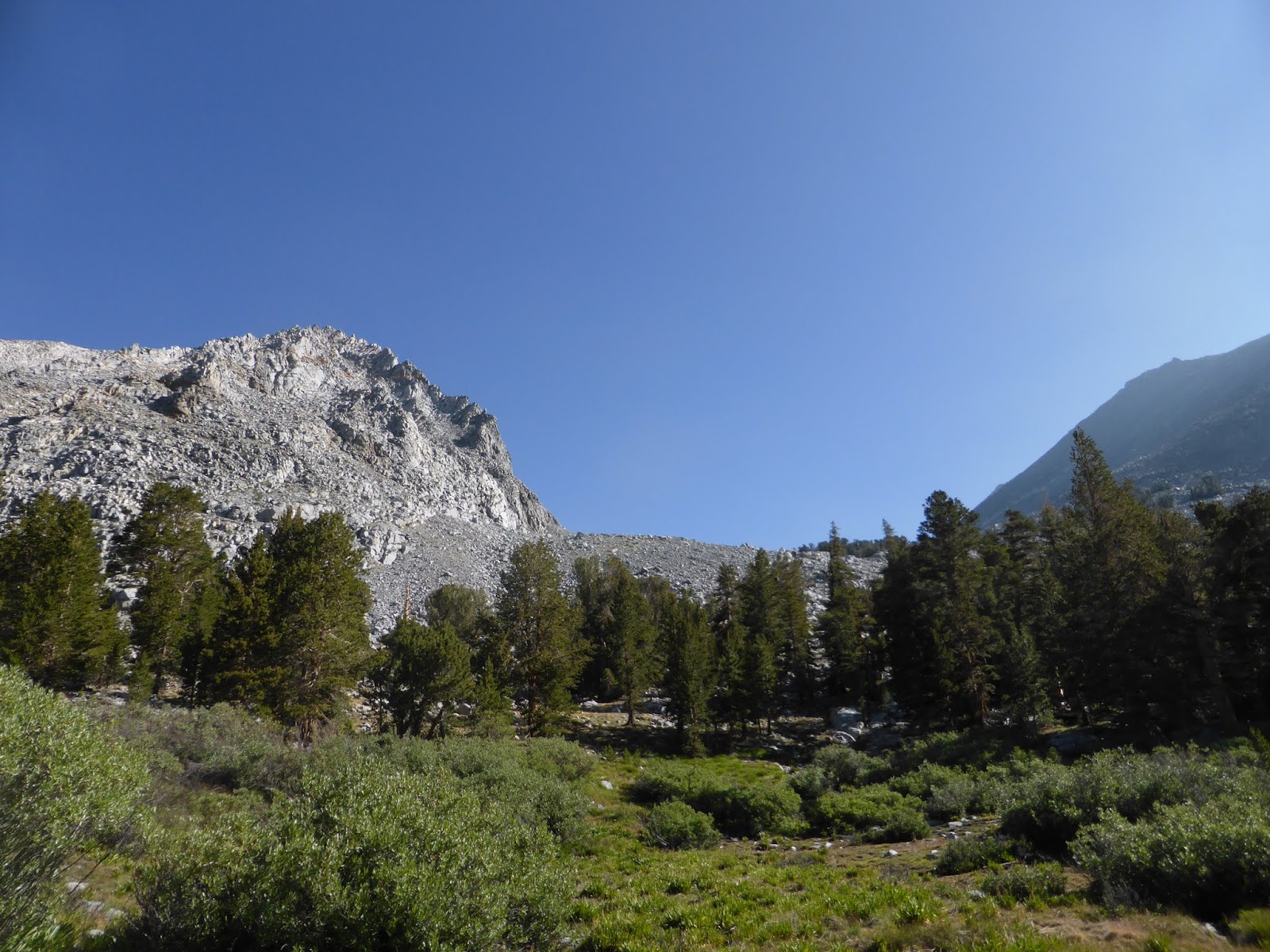
At the 9000 foot level the trail takes a northerly turn leaving the burn area and enters a zone of lush green forest and virgin meadows before finally entering another talus field and the final push to the top. A quick word about the upper meadow.... take the time to get off the trail and enjoy it. Not often will you find a Sierra plant community with so much variety, in such perfect harmony, more of a garden with the perfect gardener- nature doing all the work under the watchful eye of the massive Diamond Peak.


Trail conditions on the west side. The path has light use and no maintenance by SEKI so be prepared to lose the trail and rely on ducks to find it again, especially in rocky areas, meadows and blow downs. After descending the pass, the trail skirts around Baxter lake then veers north and away from the other lakes contained in the basin. After descending a wall of talus and timber, the trail terminates at Dollar Lake on the JMT. Just before you enter the canyon down to Woods creek, there is a statement by previous hikers on ducks:

Trip summary. My original plan was to explore two isolate groups of lakes, the first contained within the Baxter creek system west of Acrodectes Peak, the second, in a hanging valley lake system on the west side of Woods creek, 3 miles below Dollar Lake (WL-3144 on Topo maps).


Acrodectes Peak, or "the Beetle"

Plenty of room to pitch a tarp.

I abandoned any hope of getting to WL-3144 when I got to the take off point from the JMT too late in the day to negotiate the 1500 foot timbered ridge wall complete with blowdowns and ledges. This brief stint on the JMT was worth the trip just to experience the excellent tread and marvel at such a diversity of use, including groups of joggers, dayhikers, through hikers, and section hikers doing the Rae Lakes Loop. Quite the crowd, I must say!
Trip Highlights. My backcountry interests are exploratory fishing, followed closely by lazy mornings around camp, and this area allowed me to do just that. After fishing most of the lakes, I discovered the lakes do have some diversity, the lower chain of lakes contained small Goldens, and the upper chain, Brookies to 12".


Best of all was the dayhike up to a group of lakes west of Acrodectes Peak, seeing fish rise and splash the surface, then fishing these waters all day, surrounded by high mountain peaks and ridges in all directions. My original plan was to camp there, but glad that I did not. the entire landscape was talus, with nothing level to bed on.
Ready for a day hike to unnamed lakes.

The talus wall needed to be climbed.
View from the first pond.

The first pond.


The upper lake was much larger.

[
Wish I would have.... Visited the upper lake just south of Baxter Lake in a small basin of high steep cliffs and a snow field. I doubt that it had fish, but the whole time I was in the area, I could here rocks rolling down and echoing across the valley. To see the lake and hear the echoes in such a canyon would revel any cathedral in Europe.

Final thoughts. Obviously this area is not on anyone's list to sample scenic beauty and lunkers, but sometimes the best view is from afar, and this area does not lack in classic eastern high sierra vistas beautiful flora and a variety of fish that were always eager to check out my flies. The nights were chilly, down to 38 degrees and long pants are advisable because of all the overgrown trails and blowdowns.
No comments:
Post a Comment